Steer Home

Main navigation (UK)

  • Sectors
    • Transport
      • Active travel
      • Aviation
      • Freight & logistics
      • Ports & maritime
      • Rail, bus & transit
      • Roads, bridges & tunnels
      • Urban & rural mobility
    • Places & communities
      • Commercial real estate & housing
      • Community planning
      • Economic development & regeneration
      • Education & health
      • Leisure, arts & culture
      • Sports & major events
    • Resources
      • Energy
      • Property & land
      • Telecommunications & data
      • Water
  • Services
    • Advisory & financial
      • Market research & intelligence
      • Demand & revenue forecasting
      • Business & financial modelling
      • Capital programme advice & assurance
      • Project financing
      • Commercial & technical due diligence
      • Economic impact
    • Strategy & policy
      • Policy development
      • Business case & advocacy
      • New technologies
      • Regulation & competition
      • Sustainability & climate resilience
      • Strategy & management consulting
    • Planning, delivery & experience
      • Community engagement
      • Network design & operation
      • Cost modelling & strategies
      • Feasibility design & detailed design
      • Information & wayfinding
      • Infrastructure & development planning
    • Underpinning capabilities
      • Data science & analytics
      • ESG
      • Equity & inclusion
      • Monitoring & evaluation
  • Projects
  • Insights
Regions
  • Global
  • North America
  • Latin America
  • Europe
  • UK & Ireland
  • India
Search
Contact
  1. Home
  2. Projects
  3. Passenger wayfinding & information system for Rome’s new metro line
Metro C SpA, Italy

Passenger wayfinding & information system for Rome’s new metro line

With a length of 25.5 kilometres and 30 stops, Rome's Metro C Line is one of the largest routes ever undertaken in Europe. It will serve as the city's third underground line, connecting the eastern suburbs to the historic city centre. 

We were appointed to develop the station wayfinding and passenger information programme for Metro C, working closely with the architectural and engineering teams to deliver full sign schedules, including information planning, sign location and content for all signs and structures.  

Influenced by an understanding and recognition of the importance of retaining familiarity for users of Roma Metropolitana, the design uses font, colours, layout, messages and symbols akin to the main metro network.  

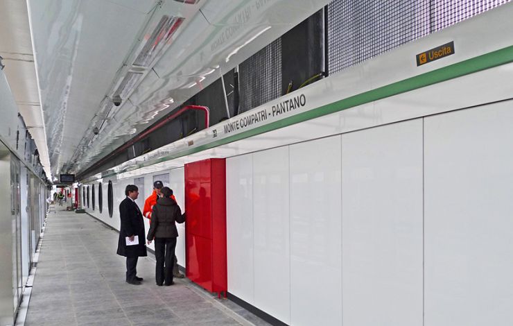
New elements brought by Metro C, such as platform screen doors for automated trains, required the expansion of the traditional wayfinding signage system into a wider family of sign products. The system adopted is very simple and clean and extremely effective at the same time. The wayfinding is integrated in the architecture wherever possible, reducing the need for accessory signing structures. This results in uncluttered environments, where signs are positioned consistently and visibly, which helps usability and legibility.  

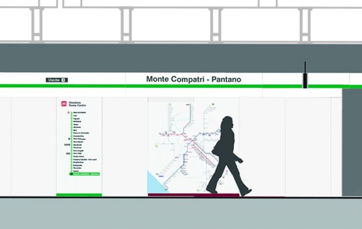
Our team delivered a full wayfinding manual including design guidelines and rules for sign positioning and orientation, font sizing to ensure optimal legibility, fabrication materials, a bespoke family of pictograms and customised line diagrams, as well as emergency and statutory signing requirements.

On
Steer group

We are Steer

Yes, you are in the right place. After 40 years, we have changed our name from Steer Davies Gleave to mark our growing international footprint and our expanding portfolio into sectors beyond transport.

Explore our new website to learn more about Steer: who we are, how we work and what our future holds.

Complex challenges.
Powerful solutions. 

Footer (UK)

  • Sectors
  • People
  • Services
  • About
  • Projects
  • Careers
  • Insights
  • Contact
  • Events
  • Our impact

©2025 Steer      Legal & policies        Cookie settings

Subscribe to our newsletter

  • Facebook
  • Twitter
  • Linkedin
  • Instagram
  • Spotify

Back to top